Deciding between photogrammetry and LiDAR for 3D mapping projects can be challenging. This comprehensive guide will help you understand the main differences, including accuracy, cost, and ideal use cases for each technology.
Key Takeaways
- Photogrammetry uses overlapping images for 3D mapping, while LiDAR employs laser pulses for precise distance measurement, each serving distinct applications across industries
- LiDAR excels in accuracy, capable of millimeter-level precision even in complex environments, whereas photogrammetry is more cost-effective and effective in well-lit conditions
- Combining photogrammetry and LiDAR enhances data quality, allowing professionals to leverage both visual detail and high accuracy in their mapping projects
- Future Intelligence Tech applies both technologies in real projects across Saudi Arabia, delivering accurate measurements, clear visuals, and reliable 3D models for planning and analysis
Understanding Photogrammetry and LiDAR

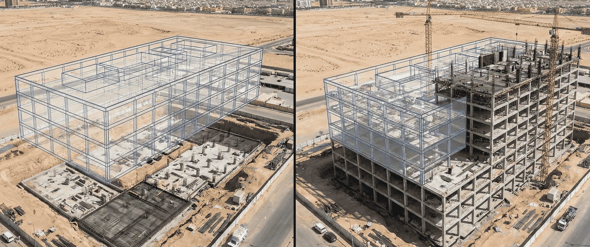
Photogrammetry and LiDAR are the two primary technologies employed for creating 3D maps and models. While photogrammetry relies on overlapping images to create 3D models, LiDAR employs laser pulses to measure distances. Photogrammetry is a passive measurement method, constructing 3D models by analyzing multiple photographs without emitting signals. Together, these technologies have transformed the field of aerial mapping, enabling precise and efficient data collection.
The integration of drones has further revolutionized the industry, making these technologies more accessible and versatile. Understanding the fundamental principles behind photogrammetry and LiDAR helps in fully utilizing their capabilities.
In Saudi Arabia, companies like Future Intelligence Tech use both methods to capture accurate aerial data for construction, infrastructure, and mapping projects.
What is Photogrammetry?
Photogrammetry is the process of capturing multiple photographs from different angles to create maps, models, and digital elevation models (DEMs). The basic principle involves interpreting photographic images to produce 3D models, photogrammetric data, and spatial data. By acquiring numerous photographs from various angles, photogrammetry derives accurate measurements and creates detailed representations of objects.
This technology relies heavily on image overlap, requiring a high degree of precision in camera calibration and positioning. Photogrammetry often requires extensive training to achieve dependable and consistent results, especially for less experienced users. Typically, a 60-90% overlap in images is necessary to ensure accuracy and successful creation of 3D models. With the advent of drone photogrammetry, the process has become more accessible and efficient, allowing for large-scale topographical mapping projects to be completed with ease.
However, photogrammetry has its limitations. It depends on the quality of captured images and can struggle in poor visibility or areas lacking texture. Despite these challenges, photogrammetry excels in creating visually detailed models and is widely used in various industries, from construction to environmental monitoring.
What is LiDAR?
LiDAR (Light Detection and Ranging) is a remote sensing method that sends rapid laser pulses toward a surface and measures how long they take to return. By calculating this travel time, the system generates highly accurate 3D information and distance measurements. The process includes:
- Emitting laser pulses that reflect off objects and return to the LiDAR sensor
- Calculating precise distances based on the returned pulses
- Creating detailed point clouds with millions of data points
- Providing valuable information on the shape, location, and elevation of objects
LiDAR systems require specialized components, including Inertial Measurement Units (IMUs) and GPS or GNSS data systems, to accurately determine the sensor’s orientation and location. This combination enables LiDAR to produce high-resolution 3D maps and models with millimeter-level precision, making it ideal for technical applications where accuracy is paramount.
Unlike photogrammetry, which relies on visual data, LiDAR can penetrate vegetation and operate effectively in low-light conditions. This makes LiDAR particularly advantageous in environments with dense vegetation or poor lighting, where photogrammetry might struggle.
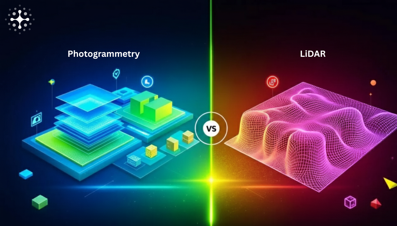
Key Differences Between Photogrammetry and LiDAR
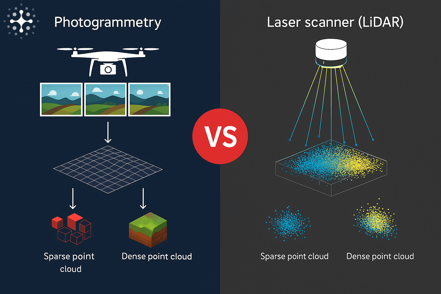
When comparing photogrammetry and LiDAR, several key differences emerge. Photogrammetry relies on overlapping images captured from cameras to derive measurements, while LiDAR uses laser pulses for direct distance measurements.
LiDAR produces detailed point clouds with precise elevation data, whereas photogrammetry generates 3D models primarily based on imagery. Both technologies find extensive applications across various industries, but their methodologies, precision, and costs vary significantly.
Data Capture Methods
Photogrammetry relies on careful planning and precise control over camera angles and overlaps to capture data accurately. The process involves acquiring overlapping images with a high degree of overlap, typically between 60-90%. These images are then processed to create 3D models and point clouds. While photogrammetry can cover more ground with fixed-wing or drone systems, it requires more extensive post-processing.
In contrast, LiDAR uses pulsed lasers to measure distances and create detailed point clouds:
- Captures millions of points per second for rapid and accurate data collection
- Produces point clouds representing shape and elevation with high precision
- Generates dense point clouds that accurately represent terrain and surface features
- Has broader scanning angles for data collection across horizontal and vertical dimensions
- Operates effectively in complex environments
Accuracy and Precision
LiDAR is known for its superior precision, often achieving millimeter-level accuracy:
- Mapping areas with horizontal accuracy of 1 centimeter
- Achieving vertical accuracy of 2 centimeters
- Ability to penetrate dense vegetation
- Capability to operate in low-light conditions
Photogrammetry relies heavily on image quality and ground control points to ensure absolute accuracy. Under favorable conditions, photogrammetry can achieve an accuracy of 1 cm horizontally. However, its effectiveness diminishes in dense forests or areas with poor visibility.
Future Intelligence Tech relies on LiDAR for projects requiring millimeter-level accuracy, especially in uneven terrain, desert sites, and highway corridors.
Equipment and Costs
LiDAR systems require specialized hardware, resulting in higher overall costs:
| Technology | Equipment Cost | Drone Cost Range |
|---|---|---|
| LiDAR | ~SAR 375,000 | SAR 187,500 - 1,312,500 |
| Photogrammetry | SAR 75,000 - 112,500 | SAR 7,500 - 75,000 |
Despite the higher investment, LiDAR’s advanced capabilities make it valuable for projects requiring high precision. Photogrammetry, not requiring expensive laser scanners, remains a more affordable solution for many mapping applications.
Benefits of Photogrammetry
Photogrammetry provides significant advantages:
- Cost-effectiveness: Generally cheaper for data collection
- High accuracy: Achieves centimeter-level precision under good conditions
- Photorealistic outcomes: Creates detailed and textured 3D models
- User-friendly: Allows individuals with photography backgrounds to adapt quickly
Benefits of LiDAR
LiDAR provides unique strengths:
- High precision: Millimeter-level accuracy
- Vegetation penetration: Captures ground data through tree canopy
- All-weather operation: Works in various lighting conditions
- Rapid data collection: Millions of points per second
- Digital terrain models: Valuable for analyzing earth’s surface beneath vegetation
Drawbacks of Both Technologies
Photogrammetry limitations:
- Requires consistent lighting conditions
- Weather conditions (rain, fog) impact data quality
- Struggles in areas with heavy tree cover
LiDAR limitations:
- Higher initial and operational costs
- Cannot penetrate solid objects
- Requires specialized training
Applications of Photogrammetry and LiDAR
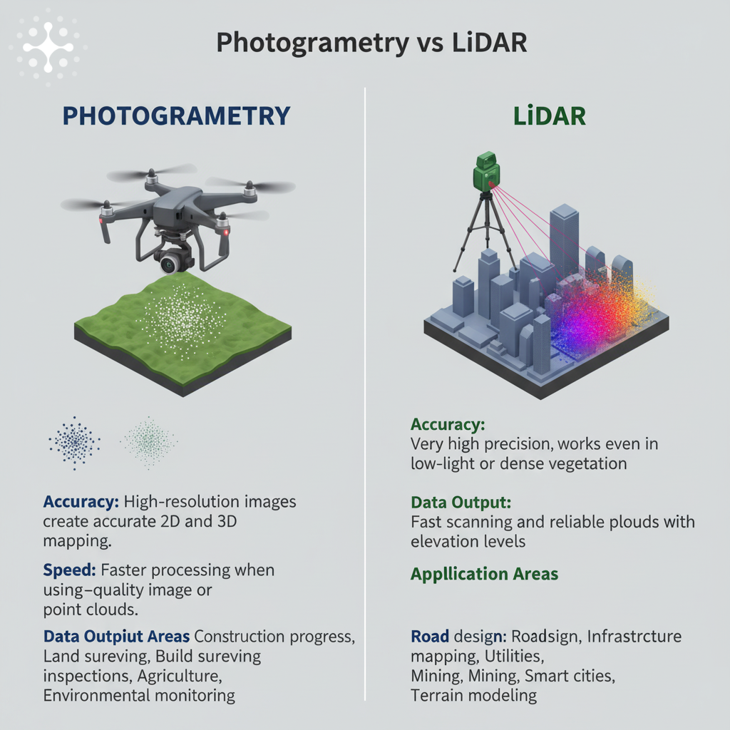
Photogrammetry Applications
- Construction: Progress tracking and site documentation
- Land development: Volume calculations and planning
- Environmental monitoring: Landscape change detection
- Archaeology: High-resolution documentation of excavation sites
- Real estate: Visual 3D models for property marketing
LiDAR Applications
- Forestry: Measuring tree height and density for forest management
- Environmental monitoring: Assessing terrain and vegetation changes
- Infrastructure: Power line corridor mapping and maintenance
- Urban planning: Detailed city modeling and analysis
- Transportation: Highway design and road condition assessment
At Future Intelligence Tech, we use photogrammetry for visual 3D models and LiDAR for accurate ground surfaces, giving Saudi construction teams a detailed view above and below the surface.
Large Scale Topographical Maps
When mapping vast areas, the choice between LiDAR and photogrammetry becomes especially important. Both technologies can produce large-scale topographical maps, but effectiveness depends on project requirements and environmental conditions.
LiDAR advantages for large-scale mapping:
- Direct measurement generates detailed point clouds
- Captures subtle elevation changes even beneath vegetation
- Produces reliable digital terrain models
Photogrammetry advantages for large-scale mapping:
- More cost-effective for open areas
- Efficient for sparse vegetation environments
- Delivers high-quality data with proper calibration
Complex Environments and Data Capture Challenges
Capturing accurate spatial data in dense forests, mountainous regions, or urban landscapes presents unique challenges.
LiDAR excels in these scenarios due to ability to penetrate vegetation and collect detailed point clouds of ground surfaces. Laser pulses reach the ground through gaps in the canopy, providing reliable elevation data.
Photogrammetry can struggle when ground is obscured, and variations in lighting or shadows impact image quality. These challenges require enhancement using specialized software and integration of GNSS data and ground control points.
Recent technological advancements have significantly improved both technologies through enhanced sensors, advanced processing algorithms, and machine learning for automatic noise filtering and data classification.
Combining Photogrammetry and LiDAR
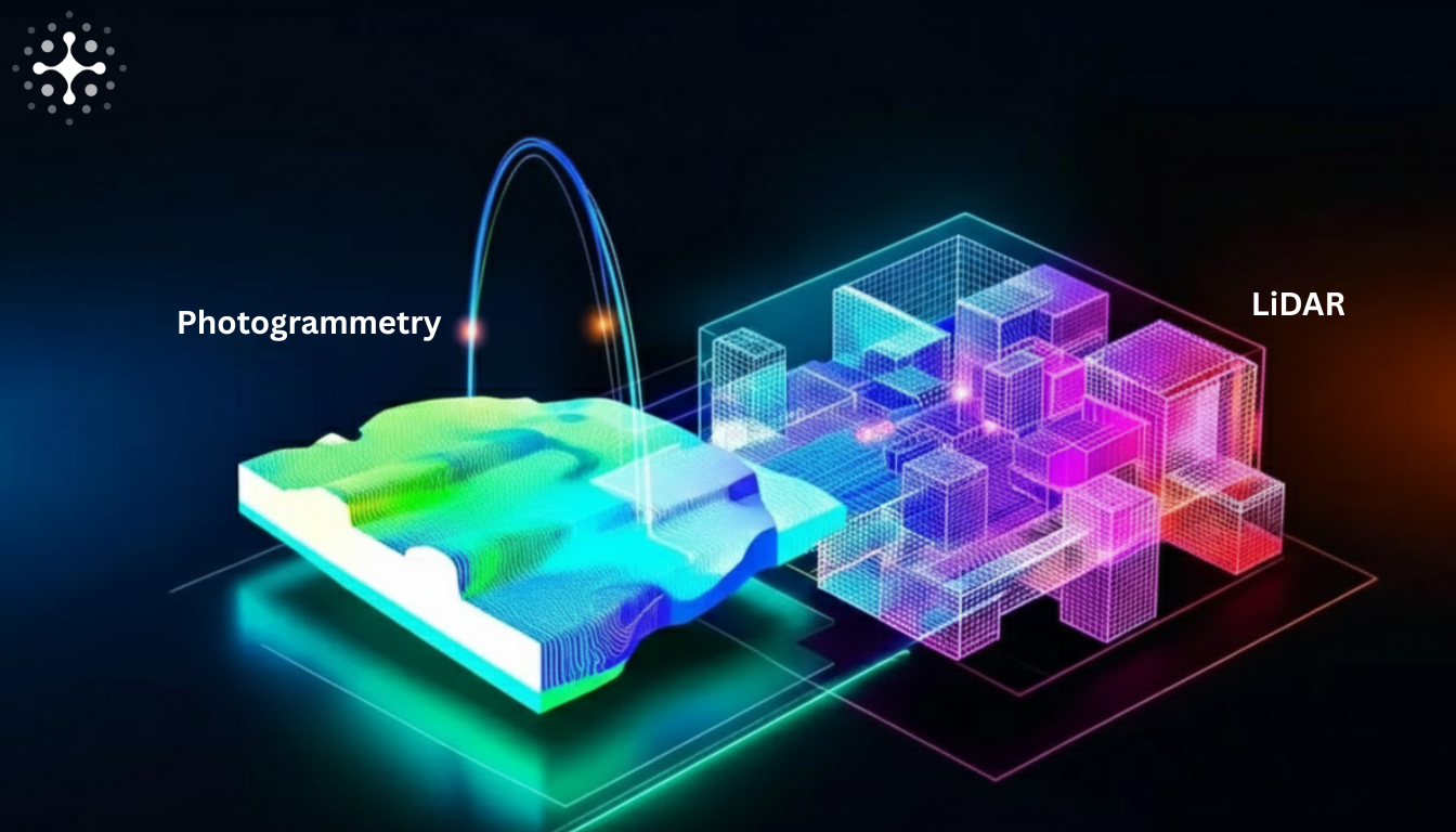
The integration of photogrammetry and LiDAR significantly enhances data quality and project outcomes. Combining depth captured by LiDAR with visual data from photogrammetry creates more detailed and accurate 3D representations.
Creating Colorized Point Clouds
A colorized point cloud combines:
- LiDAR spatial data with photogrammetric imagery
- Visually rich and highly detailed models
- Accurate representations that are easy to interpret
- Textures applied to LiDAR-derived meshes
- Both depth and visual context
Camera attachments on LiDAR systems enable simultaneous capture of imagery and laser measurements, facilitating colorization of point clouds.
Benefits of Integration
The integration results in:
- Highly accurate 3D models for advanced engineering and planning
- Greater accuracy and detail in spatial data
- Comprehensive overview of spatial environments
- Reliable inputs for planning, design, and progress tracking
Technological Advancements
Drone Integration
- Autonomous flight paths enhance data collection efficiency
- Overlapping images from various angles improve digital surface model accuracy
- Drones with LiDAR sensors capture detailed point clouds in challenging conditions
- Data collection speeds up by as much as 80% compared to traditional methods
AI and Automation
- Real-time processing of aerial mapping images
- Automated classification of terrain features
- Improved accuracy of mapping processes
- Processing times 5-10x faster with AI-enhanced methods
Choosing Between Photogrammetry and LiDAR
Project Requirements
| Requirement | Best Choice |
|---|---|
| High visual quality | Photogrammetry |
| Maximum precision | LiDAR |
| Dense vegetation | LiDAR |
| Well-lit, open areas | Photogrammetry |
| Fine structural details | LiDAR |
| Budget constraints | Photogrammetry |
Cost Comparison
| Metric | Photogrammetry | LiDAR |
|---|---|---|
| Cost per acre | ~SAR 6 | ~SAR 15 |
| Hourly service rate | SAR 563 - 1,875 | Higher |
| Equipment investment | Lower | Higher |
Environmental Factors
- Photogrammetry: Diminishes in heavy tree cover; requires good lighting
- LiDAR: Penetrates vegetation; operates in low-light conditions
Why Saudi Companies Choose Future Intelligence Tech
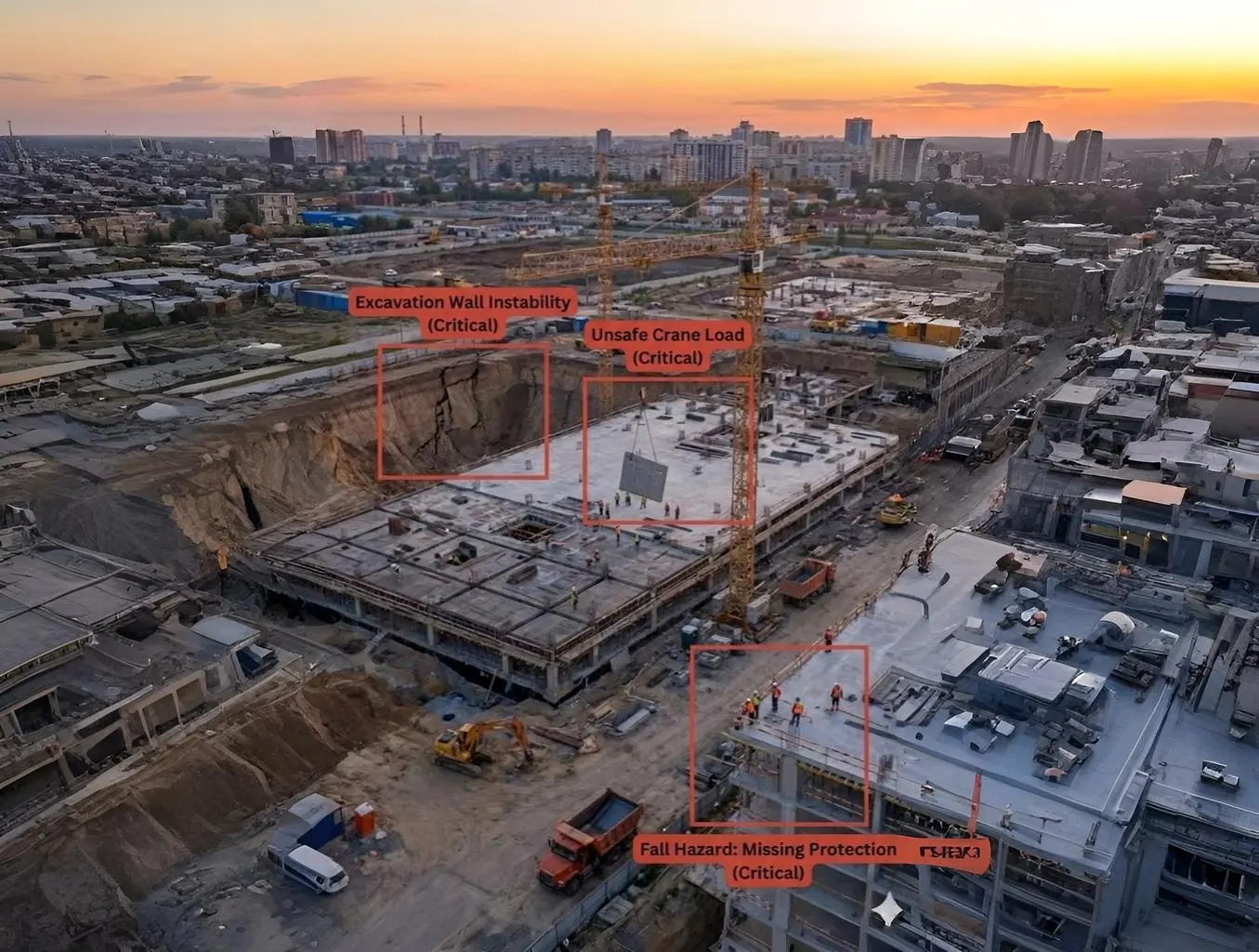
Saudi Arabia’s giga-projects such as NEOM, The Red Sea Development, Qiddiya, and Diriyah depend on fast, accurate, and reliable mapping. Contractors, consultants, and government entities rely on Future Intelligence Tech as a trusted drone and geospatial partner.
Our team delivers a complete end-to-end workflow: drone flight operations, data processing, 3D modeling, volume calculations, LiDAR scans, and AI-driven analytical reports handled by certified pilots and experienced engineers.
How We Use Both Technologies
At Future Intelligence Tech, there is no “one-size-fits-all” approach. Each project has different terrain, accuracy requirements, and visibility challenges:
- Photogrammetry: High-resolution 2D maps and realistic 3D models for construction sites, real estate developments, roads, and large-scale planning
- LiDAR: Critical accuracy requirements, vegetation environments, uneven terrain, or poor lighting
- Combined approach: Visual clarity with highly accurate elevation data for faster delivery of CAD and BIM-ready files
Summary
Photogrammetry and LiDAR are powerful tools offering unique advantages. Photogrammetry is cost-effective and ideal for detailed visual models, while LiDAR excels in precision and vegetation penetration. By understanding their key differences, professionals can make informed decisions. The integration of both technologies further enhances data quality, providing a comprehensive solution for modern mapping and surveying.
Frequently Asked Questions
What are the main differences between photogrammetry and LiDAR?
Photogrammetry uses overlapping images for 3D modeling, whereas LiDAR employs laser pulses for distance measurement and produces point clouds. LiDAR tends to be more accurate and handles challenging environments like dense vegetation better.
Which technology is more cost-effective?
Photogrammetry is usually more cost-effective because it can be done with accessible devices, keeping both initial and operational costs low.
Can LiDAR be used in low-light conditions?
Yes, LiDAR operates in low-light conditions since it uses laser pulses instead of visible light, making it reliable even when visibility is low.
How do drones enhance photogrammetry and LiDAR?
Drones boost both technologies by autonomously flying set paths to capture overlapping images and detailed point clouds, making data collection faster and more accurate.
Why would a project combine both photogrammetry and LiDAR?
Using both gives stunning visuals and precise elevation data, ensuring comprehensive and accurate information for project planning.