What “BIM-to-reality” actually requires
Five capabilities define a credible 2026 tool:
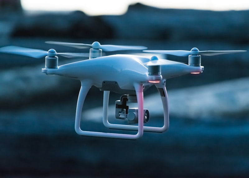
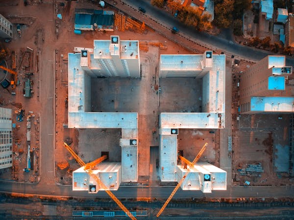
- Drone capture pipeline — flight planning, RTK support, image ingest.
- Dense matching — photogrammetry to a textured 3D mesh and a DEM.
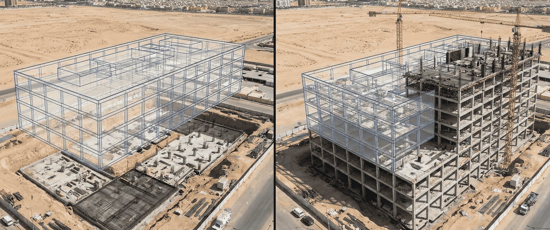
- BIM alignment — registration of the captured mesh onto the IFC or RVT model.
- Deviation reporting — element-level delta in cm and m3.
- Integration — push to BIM 360, Procore, ACC or to a native AI analytics platform.
Tools that only do steps 1–3 are visualisation, not progress tracking.
Side-by-side capability map
| Tool | Capture | Dense matching | BIM align | Deviation | KSA host |
|---|---|---|---|---|---|
| Pix4D | Strong | Best-in-class | Manual + plugin | Add-on | No native [VERIFY-SME] |
| DroneDeploy | Strong | Strong | Plugin | Add-on | No native [VERIFY-SME] |
| OpenSpace | 360 photo focus | Limited | Yes | Yes | No native |
| Autodesk ACC | Via partners | Via partners | Native | Native | Yes (Riyadh) [VERIFY-SME] |
| FI Tech | Strong | Strong | Native | Native | Yes (KSA) |
For deeper one-on-one detail see the Pix4D vs FI Tech vs DroneDeploy comparison piece. For the BIM glossary entry and the BIM comparison solution page anchor.
Where each tool wins
Pix4D — photogrammetry depth
Best for projects that need maximum point-cloud density and tight control over photogrammetry parameters. Common on heritage, archaeology and complex industrial sites. Weak on BIM-native workflows; usually paired with a separate BIM tool.
DroneDeploy — workflow simplicity
Best for owner teams that want one click from flight to deviation report. The trade-off is less control over the photogrammetry pipeline and a thinner BIM integration than ACC or FI Tech.
OpenSpace — 360-photo first
Best for indoor progress tracking via 360 cameras worn by site walks. Outdoor drone capture is supported but is not the primary workflow. See the comparison page.
Autodesk Construction Cloud — BIM-native
Best when the owner is already deeply on Autodesk and BIM 360 is the source of truth. Drone capture comes via partners (often Pix4D or DroneDeploy plugin), but the BIM alignment and deviation reporting are first-class.
FI Tech — KSA-native
Best for Saudi mega-projects where PDPL data residency, Arabic UI and IKTVA scoring are gating. Native 3D site mapping, progress tracking and BIM comparison on KSA-resident infrastructure.
Accuracy reality check
Vendors quote orthomosaic GSD and assume that translates to volumetric accuracy. It does not. Three additional metrics that matter:
| Metric | What it measures | Field target 2026 |
|---|---|---|
| Mesh-to-BIM RMSE | 3D registration accuracy | ≤ 8 cm |
| Element-level deviation | per-element delta in cm | ≤ 5 cm for primary elements |
| Volume RMSE | for stockpile-style elements | ≤ 2.5% |
Without those numbers in the proposal, the vendor is not ready for an audit-grade workflow. Cross-reference the volumetric stockpile piece for the supporting methodology.
Integration shapes that work in KSA
Three integration shapes dominate 2026 mega-project deployments:
- BIM 360 / ACC native — owner runs Autodesk; drone tool hands the deviation report into ACC issues.
- Procore-anchored — drone tool publishes daily drift reports as Procore observations.
- Native analytics platform — drone tool publishes events directly into the AI analytics platform for owners running a non-Autodesk stack.
For Procore-vs-ACC trade-offs see also the Vision 2030 construction digitisation piece.
PDPL and the cross-border question
The defining 2026 KSA constraint: where does the captured imagery and the BIM model actually live? Three patterns:
- Fully KSA-resident: capture, processing and BIM hand-off all inside CST-licensed regions. The defensible default for sensitive sites.
- GCC region: AWS Bahrain, Azure Qatar. Acceptable for some owners but explicitly not equivalent to “Saudi-resident” under PDPL Article 29.
- EU or US region: only viable with an explicit cross-border transfer mechanism and DPO sign-off. Avoided by Aramco, NEOM and most operators.
Anchor in the data residency posture and the PDPL compliance checklist.
Cost envelope
| Project size | Pix4D | DroneDeploy | ACC + partner | FI Tech |
|---|---|---|---|---|
| Single tower | 35–55k | 30–50k | 60–95k | 40–70k |
| Mid-rise complex | 120–180k | 100–160k | 180–280k | 150–230k |
| Mega-project package | 500k+ | 400k+ | 750k+ | 600k+ |
All figures SAR per year, indicative [VERIFY-SME].
Procurement traps to avoid
- Demoing the tool, not the deviation report. A polished UI with a generic deviation chart is not evidence of accuracy.
- Counting only the software — drone fleet, GCP placement, surveyor time and BIM coordinator time dominate the budget.
- Ignoring the Arabic UI — site supervisors who cannot read the dashboard will not adopt it.
Next steps
If you are scoping BIM-to-reality drone progress tracking on a Saudi project, start with the BIM comparison solution, the 3D site mapping solution and the Pix4D vs FI Tech vs DroneDeploy piece. Cross-reference the 3D site mapping BIM integration piece.
Book a BIM-to-reality scoping session and we will produce a tool comparison and integration design within 10 working days.